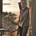

Patricia Ravine. I climbed a massive staircase to get this view, but it was well worth it.
July 7th, 2014, 5pm
I entered Patricia Ravine on Westridge Road, near its northern boundary. It’s accessible from both north and south via a granular trail, a short bridge, and two short-length staircases.
A few steps south of the small bridge, a distinct pathway climbed steeply up the bank and into the trees. This unofficial path proved to be a delightful way to travel through the ravine. Cutting through dense forest over exposed roots and beside small pockets of water, the trail was short on views but tall on getting close to the plants and trees. Eventually it rose steeply and rejoined the multi-use trail that begins on Wolf Willow Road and eventually leads to the Fort Edmonton Footbridge (about 2km from this point). I wouldn’t recommend this path for everyone - lots of exposed roots, steep sections, and narrow, sharply-cut trail segments. As stated, it’s not an official trail so it isn’t groomed or cleared. Nonetheless, eagle-eyed mappers will notice that it appears on Google Maps.
I joined and followed the multi-use trail for a few hundred meters, taking a brief detour up and down the 76th avenue access path, which wasn’t exciting, but got the heart going a bit.
The trail continued pleasantly through the forest, staying fairly flat in grade until the 158th street access path, which rose up from the main path at a decent incline and delivered me to a long, steep staircase. With my newly-minted heart valve a-pumping, I made the trip up and it was well worth it. My reward was a spectacular view of the North Saskatchewan River valley sprawling southward with the Fort Edmonton footbridge a kilometer in the distance. It was majestic and well worth the sore legs.
Other moments in Edmonton
-
Wow what should I "sketch" about?At work right now, my mind is so full of thoughts I think I'm going to enjoy this:-)
in Edmonton, Canada -
nature
Lilies in the North
in Edmonton, Canada -
nature, hiking
Meadow near Cameron Heights on a sunny Sunday morning
in Edmonton, Canada -
hiking, nature
Evening hike through Whitemud Ravine. The light was swift and lovely.
in Edmonton, Canada -
Rough day at the office, so I decided to have ice cream in the valley. The right choice.
in Edmonton, Canada -
The errant path. The happy accident.
in Edmonton, Canada -
The speed of things.
in Edmonton, Canada -
Leaves blown around in a circle. Today I am a leaf.
in Edmonton, Canada -
Blue Jay on my ride to work this morning. Time slowed a little.
in Edmonton, Canada


